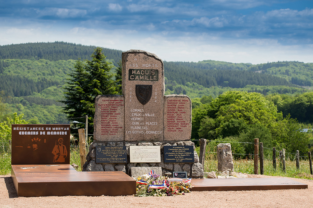
Founded in early 1944, Maquis Bernard's was based in the forest of Saint-Brisson. It was commanded by Louis Aubin, a retired policeman, aka Bernard, and Joseph Pelletier, aka Joseph. In the summer of 1944, the Maquis set up camp in the forest of Coeuzon, at Ouroux-en-Morvan, with around one thousand men. The Headquarters of the Resistance in Nièvre also based its command post here, and was used by the prefect Jacquin, appointed by General de Gaulle, making Ouroux-en-Morvan the clandestine prefecture of Nièvre.
By theme
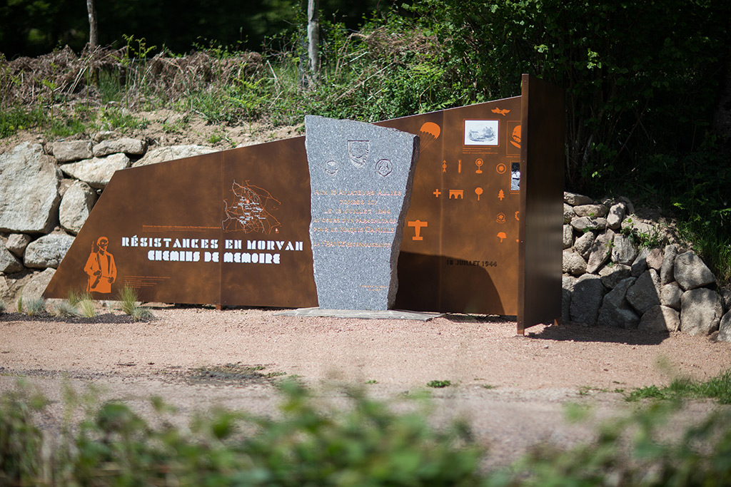
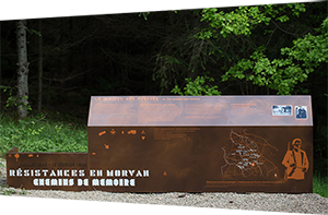
The maquis resistance groups
-
The origins of Maquis Bernard's - Croix Grenot, St-Brisson
 GPS : 47° 15' 38.002" N, 4° 4' 18.901" E - Altitude : 574m
 -
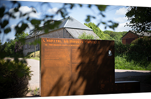
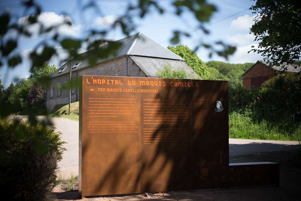
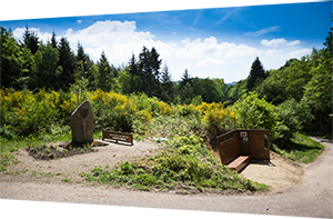
The hospital of the Maquis Camille's - Vermot, Dun-les-Places
 GPS : 47° 17' 29.4" N, 3° 58' 22.699" E - Altitude : 513m
Doctor Prochiantz, codename Martel, a young surgical intern, converted the Vermot's Castle nearby into a clandestine hospital for the Maquis Camille's. Very quickly, the solution of a single hospital turned out to be unsuitable. As of July 1944, he decided to set up a mobile team capable of going to the places where fighting was taking place in order to avoid having to transport the wounded. The complicity of local villagers then became essential as they were the ones who subsequently housed and concealed the wounded.
-
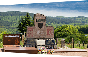
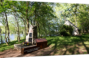
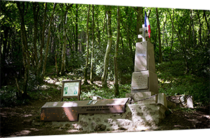
Homage to Maquis Camille's - Plainefas, St-Martin-du-Puy
 GPS : 47° 18' 5.299" N, 3° 54' 4.201" E - Altitude : 470m
Paul Bernard, codename Camille, and Jean Longhi, codename Grandjean, who came from the Paris region, sought refuge in the Morvan in 1941. After receiving the first airdrop in the Morvan on 22 November 1942 near Quarré-les-Tombes, they formed Maquis Camille's along with R. Bresson, codename Marcel, J.B. Bastard, codename Jack, and G. Liebert, codename Jojo, at the beginning of 1943. They set up their camp in the Plainefas woods until April 1944. On several occasions, the village was occupied by the enemy. But the secrecy observed by the villagers enabled them to save their own lives and prevent an attack on the maquis.
-
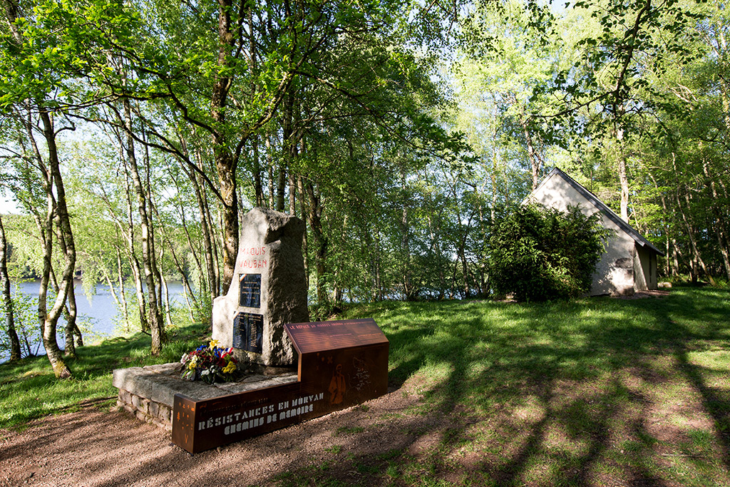
The refuge of Maquis Vauban's - Chapelle St-Pierre, Saint-Agnan
 GPS : 47° 19' 55.999" N, 4° 4' 54.401" E - Altitude : 522m
In February 1943, as the result of an enemy attack, the few survivors of Maquis Vauban's (the Francs-Tireurs and the French Partisans) set up in the region of Ravières (Yonne), fell back into the Morvan. From the end of December 1943 to 20 February 1944, twelve resistance fighters took refuge in this chapel where they lived in harsh conditions.
-
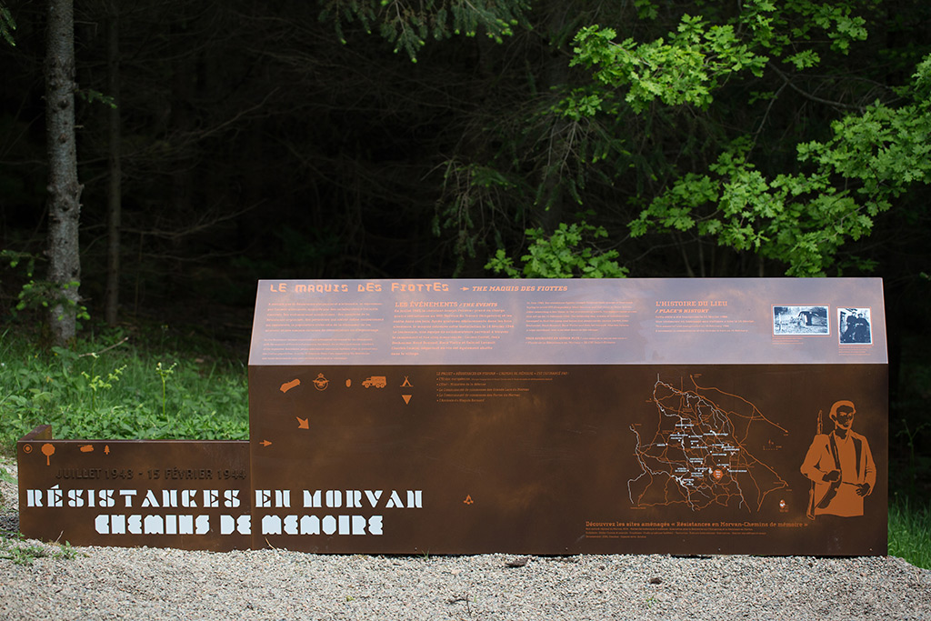
The Maquis des Fiottes - Wood of Fiottes, Moux-en-Morvan
 GPS : 47° 11' 16.598" N, 4° 8' 11" E - Altitude : 655m
In July 1943, the resistance fighter Joseph Pelletier took charge of four boys trying to avoid STO (Compulsory Work Service) and hid them in these woods. After relocating a few times in the surrounding woods, the maquis came across this set up on 14 February 1944. The following day, a team of collaborators managed to find the camp and killed five maquisards: Lucien Cortet, Jean Dechaume, René Goussot, René Viatre and Gabriel Lavault. Charles Camus, a wine merchant, was also shot down in the village.
-
Maquis of Chaumard - Cemetery, stele on the roadside et Wood of Chaumard
 GPS : 47° 8' 54.899" N, 3° 57' 16.898" E - Altitude : 523m
The Maquis of Chaumard was established in 1944 by Marcel Lemaître and Octave Bauché. Based in Chaumard Forest, this Maquis only existed for a short time, being attacked by the enemy on 31 July 1944.
Fighting and armed combat
-
The ambush at La Verrerie - La Verrerie, Montsauche-les-Settons
 GPS : 47° 10' 52.9" N, 4° 1' 27.001" E - Altitude : 558m
On 24 June 1944, eight members of British Special Forces, the SAS, and 16 maquisards from Maquis Bernard's, lay an ambush for the enemy. Fighting began. The enemy suffered heavy losses, in men, arms and munitions. The following day, in reprisal, the Germans burnt down the farms at La Verrerie and the villages of Montsauche and Planchez after evacuating the population.
-
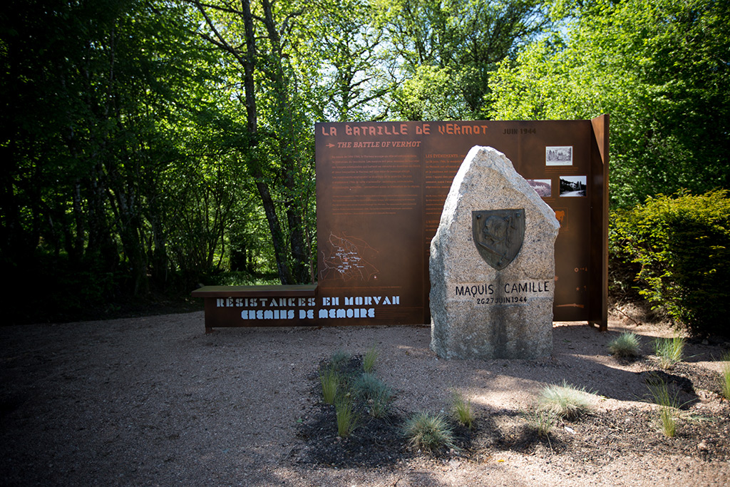
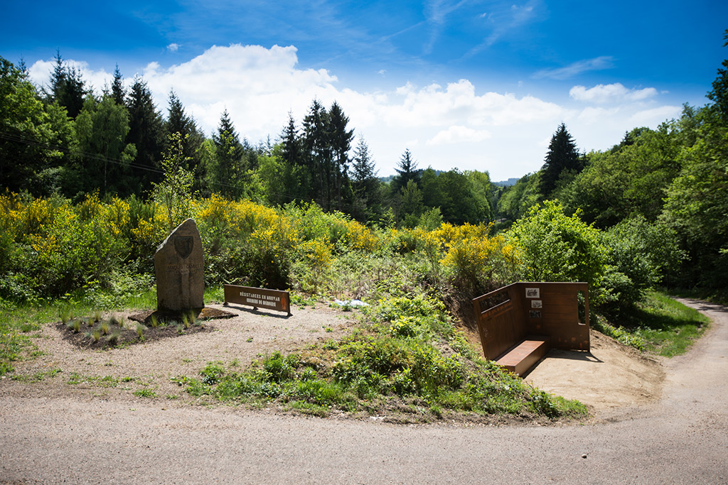
The battle of Vermot - Vermot, Dun-les-Places
 GPS : 47° 17' 27.6" N, 3° 58' 22.699" E - Altitude : 513m
On 26 June 1944, Maquis Camille's, set up behind the Vermot's Castle, was attacked by the enemy. Battle raged and the château was burnt down. The maquisards counterattacked with the support of British SAS paratroops. At nightfall, the fighting ceased but the enemy continued its campaign of terror and savage Nazi repression rained down on Vermot and Dun-les-Places.
-
The Goths farm, an impregnable camp - Chalaux
 GPS : 47° 19' 44.4" N, 3° 54' 1.001" E - Altitude : 382m
On 3 August 1944, Maquis Camille's, which had recently moved into Goths Farm, came under heavy attack. Helped by Maquis Verneuil's and British Special Forces (SAS), they stood their ground. Even in number, the enemy did not succeed in breaking through the defensive measures put in place. In reprisal, an inhabitant of Chalaux, Joseph Bachelin, was murdered and his house burnt down.
-
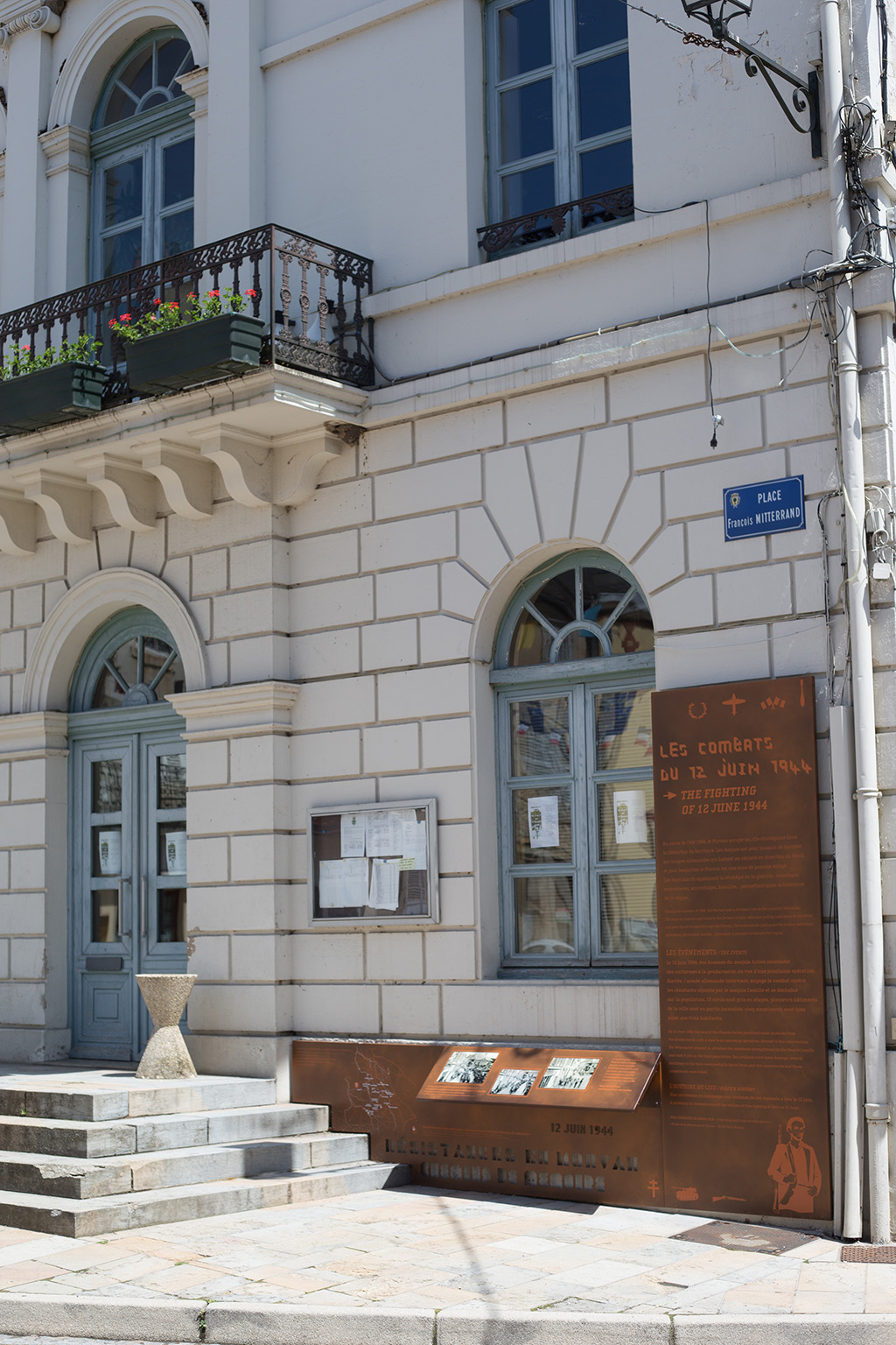
The fighting of 12 June 1944 - Town hall, Lormes
 GPS : 47° 17' 20.501" N, 3° 49' 5.999" E - Altitude : 418m
On 12 June 1944, the men of Maquis Julien's purloined some uniforms from the Gendarmerie, with a view to an upcoming operation. Alerted to this intervention, the Wehrmacht stepped in, attacked and took it out on the local population. Ten civilians were taken hostage, several buildings in the town were partially burnt down and five maquisards and three inhabitants were killed.

Martyred villages
-
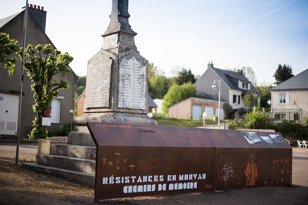
A martyr village - War Memorial, Montsauche-les-Settons
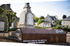 GPS : 47° 12' 52.099" N, 4° 1' 26.602" E - Altitude : 574m
On 24 June 1944, Maquis Bernard's and British SAS paratroops lay an ambush for the German troops at La Verrerie. The enemy suffered heavy losses. The following day, in reprisal, the Germans burnt down the farm at La Verrerie and destroyed the villages of Montsauche and Planchez. There was one fatality in Planchez, François Thibault, and 182 wounded; in Montsauche, also one fatality, Jean-Alexis Emery, and 302 wounded. The village was gradually rebuilt in the 1950s.
-
The massacre of Dun-les-Places - Church and cemetery of Dun-les-Places
 GPS : 47° 17' 4.801" N, 4° 0' 57.701" E - Altitude : 517m
From 26 to 28 June 1944, the population of Dun-les-Places suffered three days of horror. Around 3,000 German soldiers occupied the village and massacred part of its population, before looting and burning down a number of houses. Dun-les-Places is the martyr village in Burgundy most deeply affected during the Second World War. Soon to discover the memorial of Dun-les-Places about the inhumanity and the memory of these events.
The liberation
-
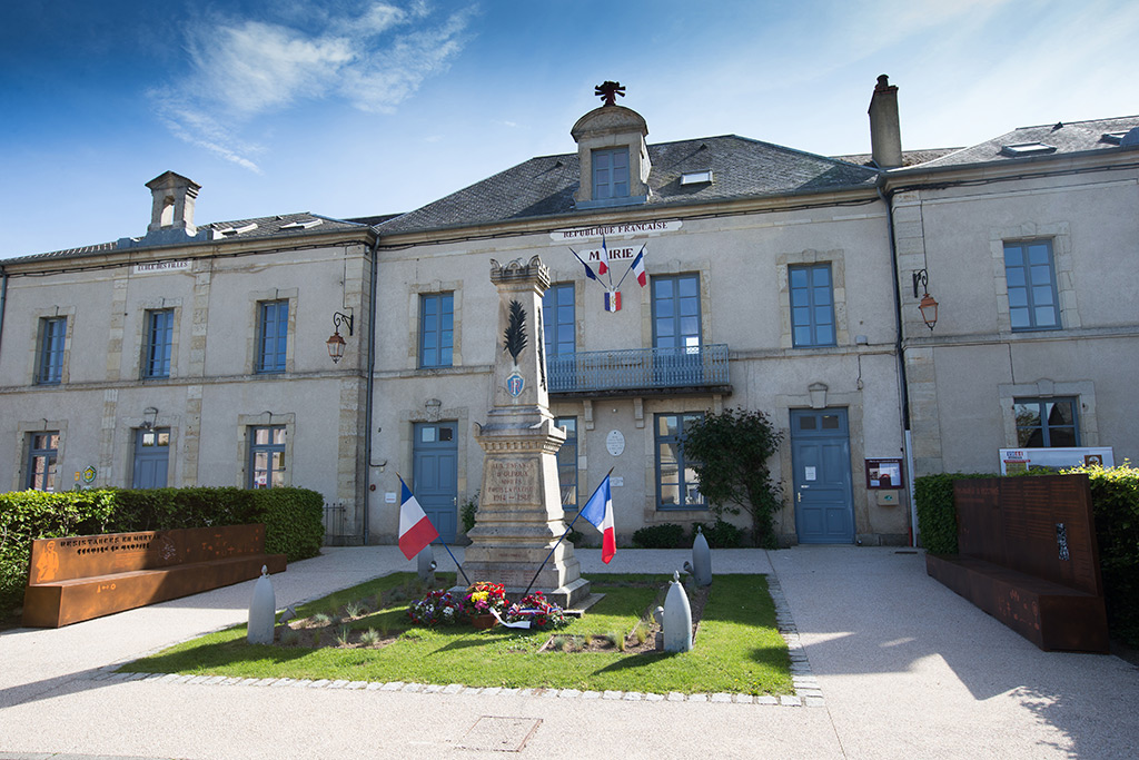
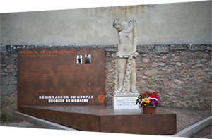
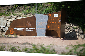
The chief of staff of the resistance - Town hall, Ouroux-en-Morvan
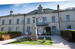 GPS : 47° 11' 7.102" N, 3° 56' 49.402" E - Altitude : 562m
In summer 1944, Ouroux-en-Morvan became the clandestine administrative head of the Nièvre. Robert Jacquin was appointed to take charge by the Provisional Government of the Republic. On 8 August 1944, the Ouroux-en-Morvan accords were also signed, uniting all of the Resistance in the Nièvre (French Interior Forces and the Francs-Tireurs and the French Partisans).
Repression
-
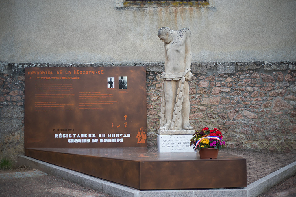
Memorial to the Resistance - Moux-en-Morvan
 GPS : 47° 10' 15.802" N, 4° 9' 11.401" E - Altitude : 491m
On 15 February 1944, five members of the Maquis des Fiottes and a villager were killed by a team of French collaborators. This memorial to the Resistance, sculpted by Jacques Bertoux and Charles Gianferrari, pays homage to the combatants of the Resistance.
-
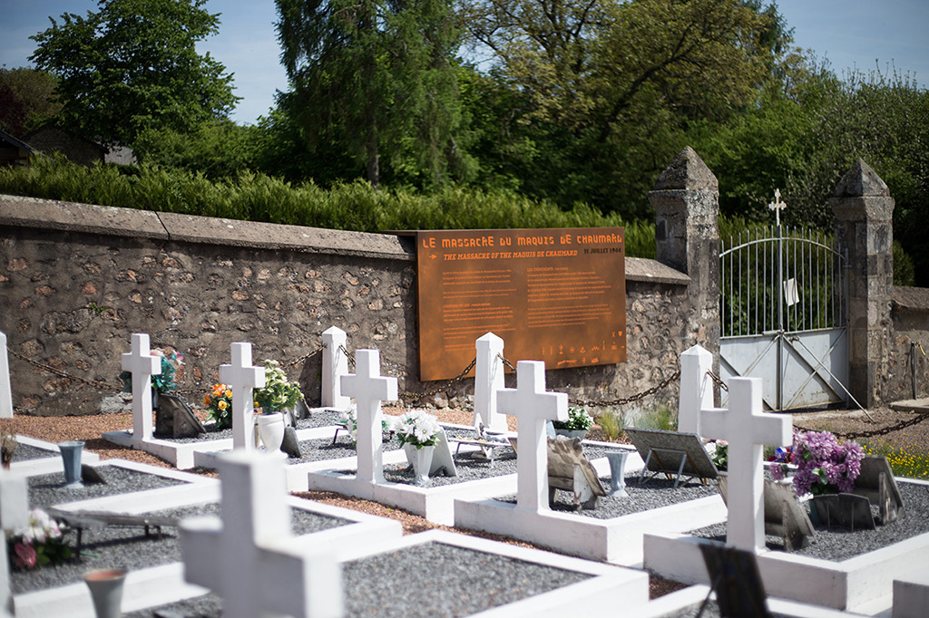
The Maquis of Chaumard massacre - Cemetery and memorial stone, Chaumard
 GPS : 47° 8' 38.9" N, 3° 54' 32.101" E - Altitude : 335m
The Maquis of Chaumard was created at the beginning of July 1944 in the village's woods by Marcel Lemaître and Alexandre Octave, codename Bauché. A victim of betrayal or espionage, the maquis was attacked at dawn on 31 July 1944. The army surrounded the camp and took the still sleeping maquisards by surprise. The effect of surprise was total. The maquis was destroyed and burnt down. Twenty-two maquisards were killed, four taken prisoner and deported.

Allies in the war
-
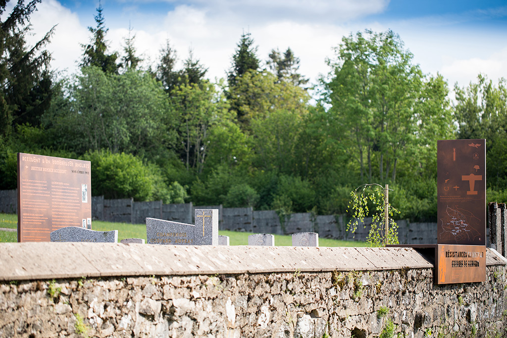
British bomber accident - Cemetery, St-Brisson
 GPS : 47° 16' 6.398" N, 4° 5' 23.5" E - Altitude : 634m
In the night of 14 to 15 February 1943, a British bomber returning from a sortie over Milan (Italy) crashed in the forest only a few kilometres from Saint-Brisson.
Four of the flight crew managed to parachute out of the aircraft, but only two members of the crew, the pilot from New Zealand, John Whyte, and the English mechanic, Stanley Eyre, survived the accident. They were then taken care of by local inhabitants and subsequently by the monks of Pierre-qui-Vire Abbey (Saint-Léger-Vauban). They managed to make their way back to England after an epic journey lasting over a year, thanks to forged identity papers and the escape networks.
Ironically, the aircraft's Merlin engines, which were responsible for the tragedy, plunged into the earth in the hamlet of Les Merlins, where a memorial can be found, to the west of Saulieu, on the border between the Nièvre and the Côte d’Or.
-
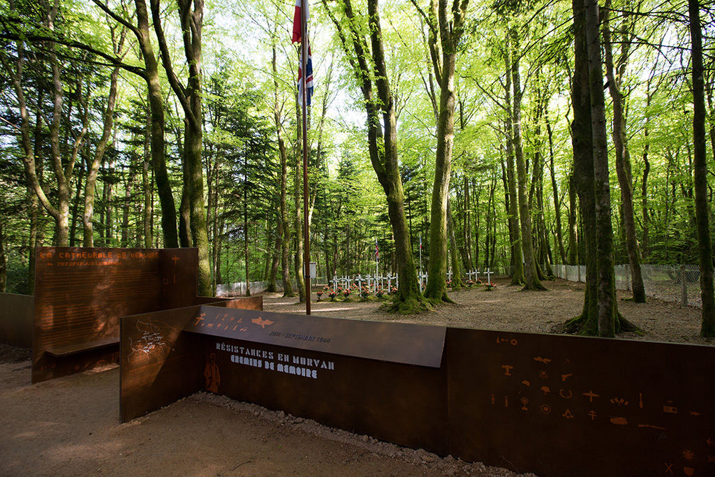
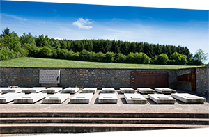
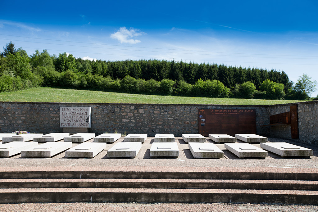
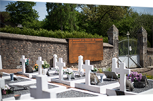
The open-air cathedral - Coeuzon, Ouroux en Morvan
 GPS : 47° 11' 8.2" N, 4° 0' 0.698" E - Altitude : 584m
During the summer of 1944, the Morvan held a strategic role in the liberation of the country and became one of the nerve centres of the French Resistance. The organised, armed maquis were supported in certain sectors by the SAS, the British Special Forces, who parachuted into the Morvan.
In the course of fighting, men and women, French and foreign, involved in this fight against Nazism and Vichy, had to face up to the possibility of death. The Maquis Bernard's, based in this forest, constructed this military cemetery in order to lay to rest the bodies of the combatants, victims of the fighting to liberate France.
-
Dramatic parachute drops - Mazignien and Marigny-l’Eglise cemetery
 GPS : 47° 19' 10.898" N, 3° 56' 47.198" E - Altitude : 429m
In the night of 18 July 1944, two parachute drops were expected, one by the British SAS and the other by the resistance fighters of Maquis Camille's. Setting out from England, two aircraft, one American, the other British, arrived over the drop zone codenamed Peinture at the same time. Dropping from the same altitude, they collided with each other. One of the two aircraft had time to drop part of its load, but both aircraft caught fire and crashed. The aircrews, all reservist volunteers, were killed. There were 15 fatalities.
The crew from the British aircraft were buried in the cemetery. A monument pays homage to the American aircrew, whose bodies lie at rest in the American cemetery in Epinal, the Ardennes in Belgium and in the United States. An unknown Russian soldier, who died in other circumstances, is also buried beside them.